

West Bengal, India
Darjeeling
Tea-garden hill station with a clear-day view of Kanchenjunga — the Toy Train is a UNESCO World Heritage railway.
Darjeeling remains an active hill station with cool, pleasant weather. Recent data shows temperatures around 17°C and moderate rainfall of about 32mm in the past week. If you visit this week, pack for occasional rain and enjoy the fresh mountain air, but be prepared for some wet conditions.
Confidence: 65%
Weather
7-day forecast☀️ Sun & Daylight
today🌅 Sunrise
05:36 AM
🌇 Sunset
05:07 PM
📸 Golden hour
04:37 PM
⏱️ Daylight
11h 30m
Dawn 05:14 AM · Dusk 05:29 PM · Critical for ADV rides — avoid mountain roads after dusk.

🧭 Travel guide — Darjeeling
Darjeeling (Nepali: दार्जिलिङ Dārjiling, Bengali: দার্জিলিং Dārjiling) is a hill station in the northern region of West Bengal. It used to be a lovely Victorian town built among the Himalayan foothills, the remnants of which are still visible around the Chowrasta. The main attractions are the cultural diversity of the Tibetan and Nepali populations. The town is also a jumping-off point for travellers heading to Sikkim.
Read full article →
📖 About — Darjeeling
Darjeeling (, Nepali: [ˈdard͡ziliŋ], Bengali: [ˈdarˌdʒiliŋ]) is a city in the northernmost region of the Indian state of West Bengal. Located in the Eastern Himalayas, it has an average elevation of 2,045 metres (6,709 ft). To the west of Darjeeling lies the easternmost province of Nepal, to the east the Kingdom of Bhutan, to the north the Indian state of Sikkim, and farther north the Tibet Autonomous Region of China. Bangladesh lies to the south and southeast, and most of the state of West Bengal lies to the south and southwest, connected to the Darjeeling region by a narrow tract. Kangchenjunga, the world's third-highest mountain, rises to the north and is prominently visible on clear days. In the early 19th century, during East India Company rule in India, Darjeeling was identified as a potential summer retreat for British officials, soldiers, and their families. The narrow mountain ridge was leased from the Kingdom of Sikkim, and eventually annexed to British India. Experimentation with growing tea on the slopes below Darjeeling was highly successful. Thousands of labourers were recruited chiefly from Nepal to clear the forests, build European-style cottages and work in the tea plantations. The widespread deforestation displaced the indigenous peoples. Residential schools were established in and around Darjeeling for the education of children of the domiciled British in India. By the late-19th century, a novel narrow-gauge mountain railway, the Darjeeling Himalayan Railway, was bringing summer residents into the town and carrying a freight of tea out for export to the world. After India's independence in 1947, as the British left Darjeeling, its cottages were purchased by wealthy Indians from the plains and its tea plantations by out-of-town Indian business owners and conglomerates. Darjeeling's population today is constituted largely of the descendants of the indigenous and immigrant labourers that were employed in the original development of the town.…
Read full article →📷 Photos nearby(12)


.jpg)
.jpeg)


Click any photo for full size and licensing info.
Recent news
No news coverage in the last 60 days — this destination doesn't get much press right now.
Recent videos
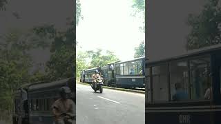
TOY TRAIN DHR #roadtrip #liriklagu #quicktrip #teamuseum #lyricsvideo #nature #fyy #journeyofficial
TravelUnfolded · 4 mo ago

Sky view of Darjeeling (West Bengal, India)
Prof. M. P. Chaudhary · 4 mo ago

Darjeeling Weather Update 🌤️ | No Rain, Crystal Clear Views & Perfect Mountain Vibes! 🏔️
Suman Halder · 4 mo ago

DARJEELING ❤️ बादलों के बीच दौड़ता हुआ एक शहर 🫶 सैर-सपाटा 🥰 #dewdrop07 #darjeeling #travalling
Dewdrop · 4 mo ago

The Amazing Darjeeling Mountain Railway (1881)
Kohinoor History travel · 4 mo ago

Lost in Darjeeling ⛰️ #Darjeeling #DarjeelingDiaries #ExploreDarjeeling #WestBengal #trending
CodingHeartz · 4 mo ago
💬 Community mentions
Places to visit in Darjeeling
4 places to explore nearby

Darjeeling
Darjeeling is a city in the northernmost region of the Indian state of West Bengal. Located in the Eastern Himalayas, it has an average elevation of 2,045 metres (6,709 ft). To the west of Darjeeling lies the easternmost province of Nepal, to the east the Kingdom of Bhutan, to the north the Indian state of Sikkim, and farther north the Tibet Autonomous Region of China. Bangladesh lies to the south

Darjeeling railway station
Darjeeling railway station is the main railway station in Darjeeling district in the Indian state of West Bengal. The station lies on UNESCO World Heritage Site Darjeeling Himalayan Railway. Darjeeling station is located at an altitude of 2,073 metres (6,801 ft) above mean sea level. It was allotted the railway code of DJ under the jurisdiction of Katihar railway division.

Dhirdham Temple
Dhirdham Temple is a Hindu temple located in Darjeeling, India. The temple was constructed in 1939 by Rai Saheb Purna Bahadur Pradhan from Nepal. The architectural design was done by Beg Raj Shakya and has a similar design to that of Pashupatinath Temple in Kathmandu.
You might also like
Trip Stories
0 storiesNo trip stories yet for this destination.
Be the first to share your experience!